Conventional Signs Chart Manufacturer,Supplier and Exporter in India
Product Code : EL-GC-10129
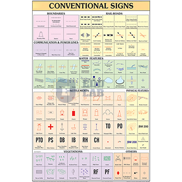
Quick Answer: The Conventional Signs Chart shows, in diagrams and lettering, the conventional signs used on maps for communications, water bodies, religious places and other features.
Last updated: October 2026
Key Features
Map signs for communications.
Signs for water bodies and religious places, among others.
Each sign drawn in diagram form with lettering, as it appears on maps.
70 x 100 cm in natural colours on 80 gsm map litho paper.
Both sides laminated with hot-seal polyester film; plastic rollers top and bottom.
Labels in English and Hindi on the one sheet.
Technical Specifications
Specification
Value
Size
70 x 100 cm
Paper
Map litho paper, 80 gsm
Printing
Multicolour, in natural colours
Lamination
Hot-seal polyester film, both sides
Rollers
Plastic, at top and bottom
Language
English and Hindi combined
About This Product
Before students can read a map they need to recognise its signs, and this chart puts those signs on the wall in the form they take on a map. During a map-reading exercise a teacher can point to a sign on the chart while students find the same sign on the sheet in front of them.
Frequently Asked Questions
What kinds of signs does the Conventional Signs Chart show?
It shows conventional signs for communications, water bodies, religious places and similar features, drawn as they are shown on maps.