
Charts
Anatomical Models
Autoclave
Lab Glassware
Physics Lab Equipment
Electronics Lab
Engineering Lab Equipment
- Civil Engineering Lab Equipment
- Data Communication and Networking Equipments
- Communication System
- Microcomputer Control Equipment
- Chemical Engineering Lab Equipments
- Industrial Control Equipment
- Refrigeration and Air Conditioning Lab Equipments
- Automatic Control Lab Equipments
- Autotronics System Lab Equipments
- Automotive Cutaways Models
- Testing Instrument Lab Equipments
- Transportation Engineering Lab Equipments
- Automotive Lab Training Equipments
- Telecommunications Engineering
- Energy Training System
- Engines and Machines Models
- Mechanics Training Models
- Building Engineering Trainers
- Process Control (PLC) Trainer
- Aeronautical Engineering Trainers
- Control and Instrumentation Engineering
- Mechatronics Models
- Thermodynamics Lab Equipments
- Measurment and Control Lab
Biology Lab Equipment
Maths Lab
Chemistry Lab Equipment
Microscope
Material Testing Lab Equipment
Vocational Lab Training Equipments
TVET Lab Equipments Manufacturers
- Plumbing Workshop Instrument
- Workshop Tools
- Standard Welding Equipment Set
- Welding Equipment and Workshop Lab Machine
- Plant Engineering and Welding Equipment
- Wood Workshop Portable Tool
- Woodworking Workshop Machines
- CNC Trainer Machine
- Training Workshop Labs
- Automobile Engineering
- Theory of Machine Lab Equipments
- Concrete Laboratory
- Soil Mechanics
- Hydraulics and Pneumatics
- Metal Manufacturing Training Machine
- Washing Machine
- Textile Technology
Astronomy Lab Equipment
Chemical Lab Equipment
Educational Lab Equipment
Lab Equipment
Science Lab Equipment
Geography Lab Equipment
School Lab Equipment
Geography Charts Manufacturer, Suppliers and Exporter in India
Educational Equipments Manufacturers is leading Geography Charts Manufacturer,and supplier and Exporter in India, Algeria (Algiers), Angola (Luanda), Argentina (Buenos Aires), Armenia (Yerevan), Australia(Canberra), Austria (Vienna), Bahrain (Manama), Bangladesh (Dhaka), Bhutan (Thimphu), Bolivia (Sucre), Botswana (Gaborone), Brazil (Brasília), Brunei (Bandar Seri Begawan), Montenegro (Podgorica), Morocco (Rabat), Mozambique (Maputo), Myanmar (Naypyidaw), Namibia (Windhoek), Nepal (Kathmandu), New Zealand (Wellington), Nigeria (Abuja), Oman (Muscat), Palestine (Ramallah), Panama (Panama City), Papua New Guinea (Port Moresby), Paraguay (Asunción), Peru (Lima), Philippines (Manila)¸ Portugal (Lisbon), Qatar (Doha), Rwanda (Kigali), Saudi Arabia (Riyadh), Senegal (Dakar), Serbia (Belgrade), Sierra Leone (Freetown), Slovakia (Bratislava), South Africa (Cape Town) (Pretoria) (Bloemfontein), South Sudan (Juba), Spain (Madrid), Sri Lanka (Sri Jayawardenepura Kotte) (Colombo), Sudan (Khartoum), Syria (Damascus), Tanzania (Dodoma), Thailand (Bangkok), Togo (Lomé), Tonga (Nuku'alofa), Trinidad and Tobago (Port of Spain), Tunisia (Tunis), Turkey (Ankara), Turkmenistan (Ashgabat), Uganda (Kampala), United Arab Emirates (Abu Dhabi), United Kingdom (London), United States (Washington, D.C.)
Educational Lab Equipment is a leading Geography Charts Manufacturer, Exporter, and Supplier in India, operating as a mass-volume, ISO 9001:2015–certified OEM manufacturing hub for national and international education programs. Based in India, the company is structurally equipped to supply thousands of standardized Geography Charts for Ministry of Education tenders, K-12 school boards, UNICEF-aligned education initiatives, and STEM Innovation Labs. Its manufacturing systems are designed for curriculum mapping to CBSE, ICSE, IGCSE, IB, and state education boards, ensuring consistency, scalability, and audit readiness. Educational Lab Equipment is regularly engaged in bulk government supplies and international tenders, positioning itself as a dependable partner for large-scale geography education infrastructure across Asia, Africa, Europe, the Middle East, and North America.
The Geography Charts portfolio includes World Physical Geography Charts manufactured under ISO 9001 process control and aligned with internationally accepted cartographic representation norms, Political World Maps verified for boundary accuracy using Ministry of Education–approved reference data, Continents and Oceans Charts quality-checked for proportional scaling under DIN-based educational illustration standards, Climate Zones Charts validated against UNESCO and UNICEF educational benchmarks, Landforms and Topography Charts reviewed for relief and contour accuracy, Soil and Vegetation Charts produced with ISO-controlled color consistency, Natural Resources Charts aligned with sustainable development education frameworks, Latitude and Longitude Charts verified for grid accuracy under geographic coordinate conventions, India Physical and Political Maps compliant with national curriculum requirements, and Environmental Geography Charts printed using RoHS- and REACH-compliant, lead-free inks to ensure classroom safety. All charts are manufactured using durable substrates, student-safe materials, and undergo batch inspection for legibility, fade resistance, and handling endurance, with packaging tested for drop resistance during transit.
For national rollouts and international programs, Educational Lab Equipment delivers full turnkey project execution, extending beyond manufacturing into kit kitting, school-wise distribution, and structured logistics planning. The company supports consolidated shipping for multi-category education supplies, standardized packaging suitable for long-distance freight, and complete tender documentation including Manufacturer’s Authorization Form (MAF) to streamline procurement approval. With proven experience in high-volume dispatch, compliance-driven production, and coordinated delivery schedules, Educational Lab Equipment enables education authorities and global procurement agencies to implement geography education programs efficiently, safely, and at scale.

Heavenly Bodies Chart
Product Code : EL-GC-10119
Size 70 x 100 cms. Each chart is printed in natural colours.
View Details
Solar System Chart
Product Code : EL-GC-10120
Size 70 x 100 cms. Each chart is printed in natural colours.
View Details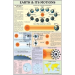
Earth and Its Motions Chart
Product Code : EL-GC-10121
Size 70 x 100 cms. Each chart is printed in natural colours.
View Details
Structure of the Earth Chart
Product Code : EL-GC-10122
Size 70 x 100 cms. Each chart is printed in natural colours.
View Details
Rocks and Minerals Chart
Product Code : EL-GC-10123
Size 70 x 100 cms. Each chart is printed in natural colours.
View Details
Atmosphere and Space Chart
Product Code : EL-GC-10124
Size 70 x 100 cms. Each chart is printed in natural colours.
View Details
Pressure and Winds Chart
Product Code : EL-GC-10125
Size 70 x 100 cms. Each chart is printed in natural colours.
View Details
Weather Map Symbols Chart
Product Code : EL-GC-10126
Size 70 x 100 cms. Each chart is printed in natural colours.
View Details
Ocean Chart
Product Code : EL-GC-10127
Size 70 x 100 cms. Each chart is printed in natural colours.
View Details
Surveying Chart
Product Code : EL-GC-10128
Size 70 x 100 cms. Each chart is printed in natural colours.
View Details
Conventional Signs Chart
Product Code : EL-GC-10129
Size 70 x 100 cms. Each chart is printed in natural colours.
View Details
Map Projection Chart
Product Code : EL-GC-10130
Size 70 x 100 cms. Each chart is printed in natural colours.
View Details
Storm and Ocean Current Chart
Product Code : EL-GC-10131
Size 70 x 100 cms. Each chart is printed in natural colours.
View Details
Phases of the Moon Chart
Product Code : EL-GC-10132
Size: 50 x 75 cm. Material: Laminated Paper
View Details
Solar and Lunar Eclipse Chart
Product Code : EL-GC-10133
Size: 50 x 75 cm. Material: Laminated Paper
View Details
Seasons and Climate Chart
Product Code : EL-GC-10134
Size: 50 x 75 cm. Material: Laminated Paper.
View Details
Spring and Neap Tides Chart
Product Code : EL-GC-10135
Size: 50 x 75 cm. Material: Laminated Paper.
View Details
Sun and Planets Chart
Product Code : EL-GC-10136
Size: 50 x 75 cm. Material: Laminated Paper.
View Details
Water Cycle In Nature Chart
Product Code : EL-GC-10137
Size: 50 x 75 cm. Material: Laminated Paper.
View Details
Directions and How to find them Chart
Product Code : EL-GC-10138
Size: 50 x 75 cm. Material: Laminated Paper.
View Details
Earth is Round Chart
Product Code : EL-GC-10139
Size: 50 x 75 cm. Material: Laminated Paper.
View Details
Physical Features of Earth Chart
Product Code : EL-GC-10140
Size: 50 x 75 cm. Material: Laminated Paper.
View Details
Day and Night Chart
Product Code : EL-GC-10141
Size: 50 x 75 cm. Material: Laminated Paper.
View Details
Earthquake Chart
Product Code : EL-GC-10142
Size: 50 x 75 cm. Material: Laminated Paper.
View Details
Latitude and Longitude Chart
Product Code : EL-GC-10143
Size: 50 x 75 cm. Material: Laminated Paper.
View Details
Hill Features, Contours and Map Setting Chart
Product Code : EL-GC-10144
Size: 50 x 75 cm. Material: Laminated Paper.
View Details
Factors that Affect Climate Chart
Product Code : EL-GC-10145
Size: 50 x 75 cm. Material: Laminated Paper.
View Details
Weather Instruments Chart
Product Code : EL-GC-10146
Size: 50 x 75 cm. Material: Laminated Paper.
View Details

Ocean Currents Chart
Product Code : EL-GC-10148
Size: 50 x 75 cm. Material: Laminated Paper.
View Details
Sunlight and Rainbow Chart
Product Code : EL-GC-10149
Size: 50 x 75 cm. Material: Laminated Paper.
View Details